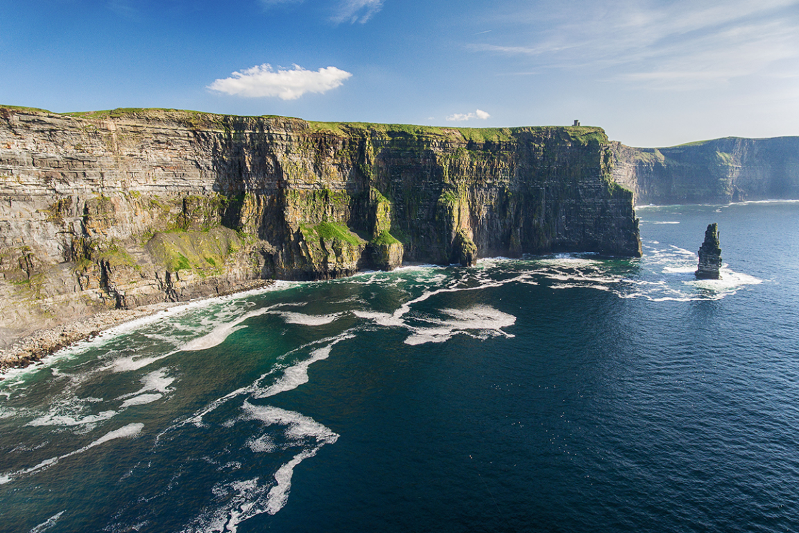
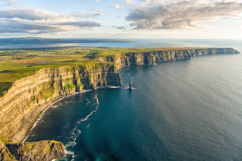
In a country like Ireland, known for its natural beauty, the Cliffs of Moher stand out as one of the highlights of this wondrous isle. It’s hard to believe anyone wouldn’t be impressed with them, irrespective of the weather on the day. Today, the cliffs are one of the most visited sights in Ireland, with more than 1.5 million people visiting annually.
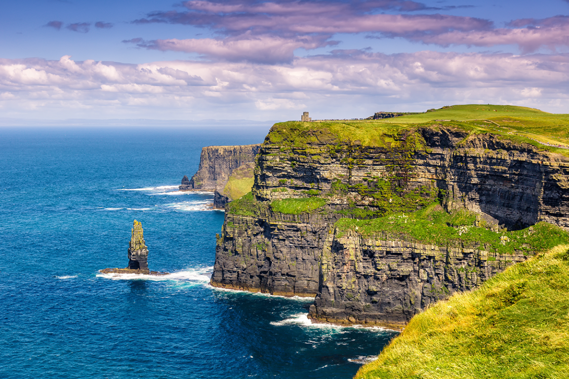
Located at the southwestern edge of the Burren Region in County Clare, the cliffs run from just north of O’Brien’s Tower for 14 km (9 mi) south to Nags Head. The cliff’s highest point is north of O’Brien’s Tower, at 214 m (702ft) above the Atlantic, and it drops to 120 m (390ft) at Nags’ Head in the south. On a good day, visitors up the tower can see the Aran Islands in Galway Bay along the Maumturks and Twelve Pins, both located in the Connemara National Park in County Galway.
The cliffs take their name from an old fort, Mothar or Moher, which once stood on the southernmost point at Nag’s Head. Today, no records exist showing when the fort was built, but we know that in 1808, it was demolished to make way for a watch tower built as a lookout for any invasion from France.
The tower still stands today and is known as the Moher tower, or Túr an Mhothair in Irish. During the early 18th century, coastal towers were typical in the United Kingdom, and Ireland as war with Napoleon beckoned.
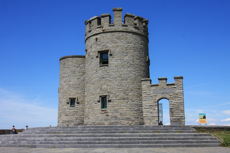
O’Brien’s Tower
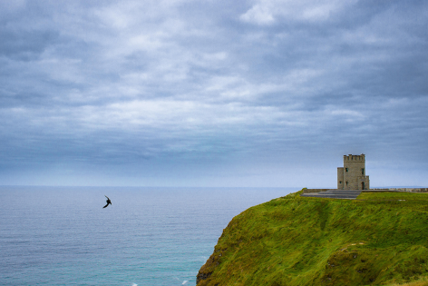
O’Brien’s Tower marks the highest point on the Cliffs of Moher. It was built in 1835 as an observation tower by Sir Cornelius O’Brien, from whom the tower is named. O’Brien, a local landlord and M.P., constructed the lookout for the numerous English visitors to the area.
“Strangers visiting the magnificent scenery of the neighbourhood.”
This was the expression O’Brien often used to attract people to the region. At one point, the tower served as a teahouse, with a large round table surrounded by seats of beautiful ironwork. Like the tower at Nag’s Head, the views on a good day are incredible. Visitors can see as far as Loop Head in southern County Clare and even into the mountains of County Kerry.
Cliffs of Moher Visitors Centre
In the early1990s, the Clare County Council began the development of a new visitor’s centre that would provide visitors with numerous amenities without being a significant man-made intrusion. After 17 years of construction, the new centre was opened, built into the hillside approaching the cliffs.
The €32 million facility includes, along with cafés and restaurants, interactive displays on geology, history, flora, and fauna. Large multimedia screens give the visitor a bird’s-eye view of the cliffs and videos of the underwater caves at the cliff’s base.
How did the Cliffs of Moher form?
The cliffs consist primarily of Namurian shale and sandstone, with the oldest rocks found at the bottom. Their formation occurred more than 300 million years ago when a river dumped layers of sand, silt, and clay into the mouth of an ancient basin.
Over millions of years, each layer was compacted, then lithified or turned to stone. Individual layers vary in depth from a few centimetres to several metres, with each one representing a different period of geological history.
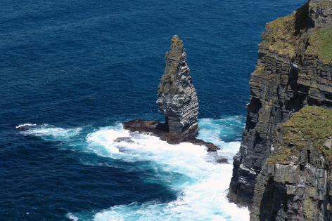
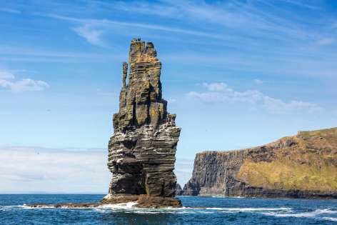
Today, the cliffs are open to erosion by the sea that chews away at the base, making the cliffs collapse under their weight. This, in turn, creates a variety of coastal landforms such as sea caves, sea stumps and sea stacks. Just below O’Brien’s Tower is the 67 m, or 220 ft, Branaunmore sea stack, which was once part of the cliffs. This process also created numerous sea arches, the most prominent being at Hag’s Head.
Wildlife
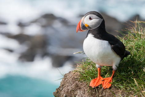
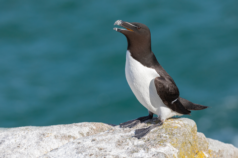
An estimated 30,000 pairs of birds live off the cliffs, divided into more than 20 species, including Atlantic puffins and razorbills. Many birds populate the Branaunmore Sea Stack and the small Goat Island off the cliffs.
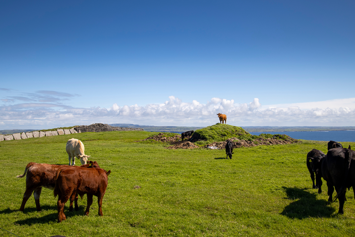
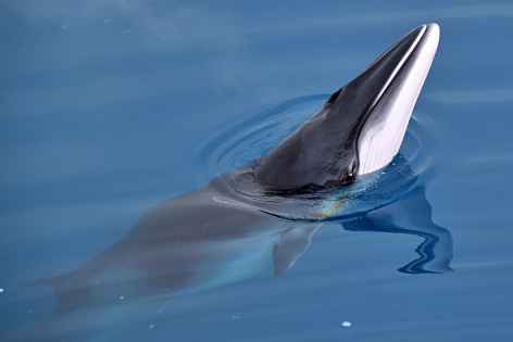
Visitors will also have the chance to see a wide range of sea life at the cliffs. These include grey seals, porpoises, minke whales, dolphins, and basking sharks. On the land, it isn’t uncommon to see goats, foxes, badgers, and Irish hares.
Burren & Cliffs of Moher UNESCO Global Geopark
In 2011, they were incorporated into the Burren & Cliffs of Moher Geopark, one of a series of Geoparks throughout Europe, collectively known as the European Geoparks Network. The Geopark, with an area of 530 km², or 204 mi², was designated a UNESCO Global Geopark in 2015.
The cliffs have appeared in several films, including, The Princess Bride (1987), where they were the Cliffs of Insanity and Harry Potter and the Half-Blood Prince. Music is also associated with the cliffs, with Maroon 5 and Westlife making music videos. Dusty Springfield, the British singer who died in 1999, had some of her ashes scattered off the cliffs by her brother Tom.
Undoubtedly, one of the must-sees on a visit to Ireland.